KGZ 26 Kavak-Too and Moldo-Too Key Biodiversity Area

Square: 12000 ha.
KBA category: В1
Availability of protected areas: no
Species that initiated the designation of KBA [and other globally threatened species that are present in the KBA but have not been confirmed to meet the global KBA criteria]: Acantholimon linczevskianum, Cousinia schischkinii, Mogoltavia narynensis, Nepeta narynensis, Seseli luteolum.
Settlements on the territory of the KBA: -
Adjacent to the territory of the KBA: -

General description: Moldo-Too is a mountain range in the Inner Tien Shan, in central Kyrgyzstan, southwest of Lake Son-Kul.
The ridge is located in the latitudinal direction between the valleys of the Kökemeren, Sonkel and Naryn rivers. The length of the ridge is about 150 km. Highest point - 4185 m above sea level . 

This is the only ridge in the Tien Shan that is almost entirely composed of limestone.
Almost the entire ridge and its spurs are composed of fairly thick Carboniferous limestones. On the lower sections of the slopes there are mountain steppes and meadows, above there are areas of spruce forests and juniper forests.
At the confluence of the Jumgala and Kökemeren rivers, the Kavak mountain range rises to the left along the stream.

Both Moldo-Too and Kavak-Too belong to the Inner Tien Shan. The slopes of the Inner Tien Shan ridges above 2000 m are occupied by coniferous forests of Tien Shan spruce, fir, and juniper. Above 3000 m there are thickets of dwarf juniper and rhododendron. Subalpine and alpine meadows, usually not forming a continuous belt, are located at an altitude of 2800 - 3400 m, alternating with rocks and screes almost devoid of vegetation; widely used as summer pastures. Syrts are characterized by high-mountain cold deserts that serve as winter pastures. Above 3200 m, nival and glacial-nival landscapes are common.

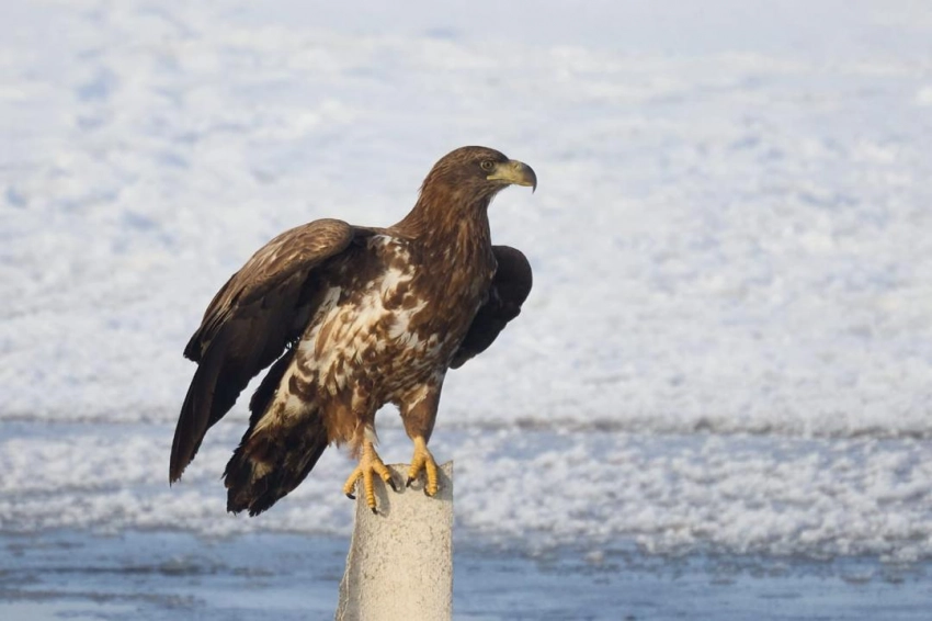
Particularly valuable and protected species: Bear, lynx, golden eagle, vulture, bearded vulture, saker falcon, gyrfalcon, black-headed gull, steppe kestrel, ibex, marmot, relict ground squirrel: mountain goose, black stork, demoiselle crane, bearded partridge, snowcock, chukar, of fish: scaly and naked osman, Amudarya trout, Severtsev's osman, peled, whitefish.

In the area covering the left bank of the river. Kokomeren, the Kavak, Akshiyrak ridges and the western part of Moldotoo are home to 15 species of rare plants, two of which are endemic.
Main types of ecosystems: Floodplain forest, subalpine and alpine meadows.
Among the species, the following should be noted: Schrenk spruce, Tien Shan spruce, juniper tree and elfin juniper, rose hips, honeysuckle, willow, currant, sea buckthorn.

Attractions: Moldo-Too is famous for its caves. The last research related to the caves was carried out by geologists in 1975, this was one expedition that found 11 caves and several sinkholes in one of the small karst areas.
In 2017, Kyrgyz and British speleologists carried out reconnaissance of some karst areas. Many grottoes have been found at different levels of the canyons. The height of the canyon walls is up to 300-400 meters. On vertical rock walls there are many grottoes associated with tectonic faults and strata.

The huge karst areas of Moldo-Too require many years of research. According to the chemical composition of water from karst springs, it is predominantly calcium bicarbonate, calcium-magnesium hydrocarbonate, and rarely magnesium-calcium sulfate.

Ecology: The Kavak coal basin is located next to the KRB. The area of the coal basin belongs to the Jumgal district of the Naryn region of the Kyrgyz Republic, the total length of which is about 75 km. The basin is limited to the West by the Koko-Meren River, to the East of Lake Son-Kol, to the South by the Moldo-Too ridge, and to the North by Kavak-Too . 

Brown coal reserves are being mined here. This is accompanied by environmental problems: regarding the withdrawal from use of lands occupied by the development objects themselves, corresponding auxiliary services and structures, and areas under rock dumps: pollution of water, soil and air; destruction and reduction of vegetation; damage to the hydrological system of reservoirs and groundwater; significant changes in landscapes; an increase in the incidence of illness among workers of coal mining enterprises and residents near populated areas, and many others. etc.

The most powerful sources of atmospheric dust are large-scale explosions, which often emit a methane-air mixture and oxidation products into the atmosphere.
Discontinued or abandoned coal mines and brownfields remain an active source of air pollution.
In the process of open-pit coal mining, large areas are occupied by hydraulic dumps, leading to intense pollution of ground and surface waters.

In the Kavak coal mining basin, as a result of mining activities, about one thousand hectares of natural mountain surface have been disturbed.
It has been established that heaps of waste and dumps of substandard coal in the Kavak coal basin have a total mass of more than 500 thousand tons. Coal dumps with 10-30% ash content in waste dumps and dumps occupy significant areas, about 100 hectares.
Coal mining is usually accompanied by various noises, which, together with other processes, has a synergistic negative effect on people’s health, causing respiratory diseases (silicoanthrosis, dust bronchitis), deterioration of the skin, hair loss, damage to teeth, and the finest dust, penetrating into the blood, accumulates toxic substances and generally affects the demographic situation of the region.
______________________________________________________
* Sources of information: Moldotau // Great Soviet Encyclopedia: [in 30 volumes] / ch. ed. A. M. Prokhorov. — 3rd ed. - M.: Soviet Encyclopedia, 1969-1978.
** Based on materials from the Foundation for the Conservation and Research of Caves, Kyrgyzstan.
*** https://vak.kg/wp-content/uploads/2022/05/Avtoreferat_Sharshenova-Damira_russk.pdf
Материалы по теме: