KGZ20 Isfayram-Shakhimardan Key Biodiversity Area

Area: 220,000 hectares.
KBA category: B1
Species that initiated the designation of the KBA [and other globally threatened species that are present in the KBA but have not been confirmed to meet the global KBA criteria]: Acantholimon langaricum, Astragalus khassanovii, Bupleurum isphairamicum, Cousinia jassyensis, Crataegus isfajramensis, Eremurus zenaidae. Ferula alaica. Ferula subtilis, Incarvillea olgae, Nathaliella alaica, Neuroloma botschantzevii, Neuroloma tianschanicum, Pedicularis popovii, Phlomis drobovii, Phlomoides pulchra, Phlomoides stellata, Physochlaina alaica, Saussurea schachimardanica, Scutellaria nepetoides, Seseli alaicum, Semenovia alaica, Stubendorffia botschantzevii, Stubendorffia curvinervia.
Availability of protected areas: yes
Settlements on the territory of the KBA: Orozbekovo, Dzhyidelik, Kadamzhai, Pulgon
Adjacent to the territory of the KBA: -

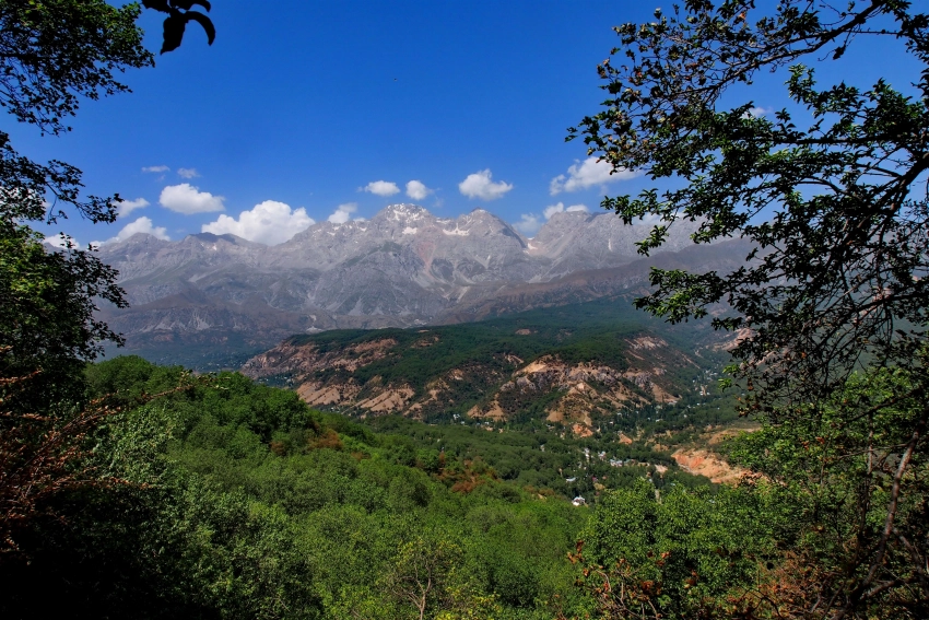
General description: The territory of the KBA is formed by the valleys of 2 rivers - Isfayram-Sai and Shakhimardan and the adjacent mountain ranges. Isfayram-Sai is a tributary of the Syrdarya River. The length of the river is 122 km, the basin area is 2220 km². It originates in the spurs of the Alai Range. In the upper reaches the river is called Tengizbai. The river originates from the confluence of two mountain rivers - the Surmatash River in the gorge of the same name and the Langar River.
Isfayram-Sai is fed mainly by snow and glaciers. The maximum volume of water occurs in May-August - the minimum in December-February. The average water flow near the village of Uchkurgana in Kyrgyzstan (the beginning of the irrigation fan) is 21.1 m³/s. Average water flow is 21.9 m³/s.
Isfayram-Sai in the full-flow period, mainly in summer, is a rapid stream with chocolate-colored water due to admixtures of sand and clay. The water is very cold.
The riverbed is distinguished by the presence of very dense tugai forests, in which mainly wild poplar, oleaster (zhiyde), sea buckthorn, rose hips and other shrubs and trees grow. The Isfayram-Sai River provides drinking water to about 50% of the Kadamzhay district, as well as residents of the city of Kyzyl-Kiya.

The KBA also includes the upper reaches of the river*, left tributary of the Syrdarya. The length of the river is about 112 kilometers. Feeding is snow-glacial with peak floods in June. The Shakhimardan River is formed at the confluence of the Ak-Suu and Kok-Suu rivers, which originate on the northern slopes of the Alai and Turkestan ranges.
The Kok-Suu River originates in Lake Kurban-Kol. The beginning of the river is considered to be from the mountain (peak) Collector. The river is fed by 20 glaciers. Along its length, it cuts through the intermountain plain of Katran-Too.
The Shakhimardan River flows to the northwest, crossing the border of Kyrgyzstan and Uzbekistan. East of the village of Orozbekovo it turns north, flows through Dzhyidelik, Kadamzhai and Pulgon, again crosses the border of Kyrgyzstan and Uzbekistan and enters the Fergana Valley in the village of Vuadil. Below Vuadil is known as Margilansai, where the city of Fergana is located.

The average long-term water flow of the Shakhimardan River is 11.6 m³/s, the flow rate is 9.66 m³/s, the average annual flow in the average year for water availability is 275 million m³, which is 1.5% of the flow of the Fergana Valley. During floods, the flow reaches 64 m³/s. The river waters are completely used for irrigation due to the construction of numerous drainage canals.
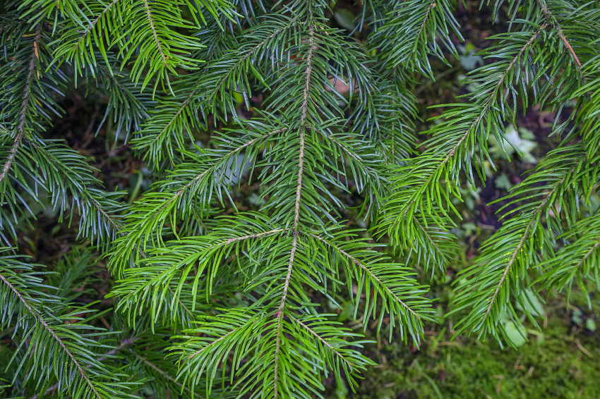
Along the banks of the Shakhimardan River there are juniper forests and shrubs.

Attractions: In the upper reaches of the Isfayram-Say River there is the Surmatash State Nature Reserve, formed in 2009. In 2021, employees of the National Academy of Sciences of the Kyrgyz Republic identified more than 200 wild apricot trees in the upper reaches of Surmatash. The age of these trees ranges from 13 to 200 years. In 2021, 26 camera traps were installed in the upper reaches of Surmatash by the Ilbirs public foundation, which captured many wild animals, including snow leopards.
The location of the Surmatash Nature Reserve is very convenient for the development of equestrian and hiking tourism. From these places, horse routes and transitions are offered to the south - to Chon-Alai, to the west - to the Shakhimardan River basin and to the east - Abshir-Sai.

Another attraction is the blue lake Kurban-Kol. The water in this lake is bluish-green in color and has high drinking qualities. In winter, the lake partially freezes near the shores. The water temperature, even in summer, barely reaches 8-10 degrees. Kurban-Kol is surrounded by gray-yellow rocks, the slopes of which steeply descend to the reservoir. The Kok-Suu River flows into the lake in the north.
The name Kurbankol means “sacrificial lake”. The reservoir is a local shrine and is an object of Muslim pilgrimage. There is a cable car leading to the revered place.

The lake is located 6 km southeast of the village of Shakhimardan on the territory of Uzbekistan at the southern border of the Shakhimardan exclave. Muslim legend says that the village of Shahimardan was visited by Hazrat Ali himself, the fourth caliph, son-in-law of the Prophet Muhammad, and here is one of his possible seven graves. “Shakhimardan” translated from Persian means “ruler of people,” which also correlates with the name of Hazrat Ali. The village also houses the mausoleum and grave of the famous Uzbek poet Hamza Niyazi, who was killed in Shakhimardan.

The Sary-Tash valley with its smaller rivers Taldy-Bulak and Uuru-Sai is also picturesque. The gorges in this area are Mergen-Tash, Korotu. In the upper reaches there is Lake Tolbos-Kol. The tourism potential of the area is very large. Today, the Gavyan Plus base welcomes guests here. Tourist routes can go south towards Chon-Alai, east towards Shakhimardan and Isfayram-Sai and west towards the Leilek region.

Useful links: Petroglyphs of the Gavyan gorge (Batken region, Kyrgyzstan) - https://cyberleninka.ru/article/n/petroglify-uschelya-gavyan-batkenskaya-oblast-kyrgyzstan
*Also a transboundary river (Kyrgyzstan, Uzbekistan).


