KGZ03 Sumsar Key Biodiversity Area

Square: 2000 hectares.
KBA category: B1
Protection areas: no
Species that initiated the designation of KBA [and other globally threatened species that are present in the KBA but have not been confirmed to meet the global KBA criteria]: Аканталимон карабаевых (Acantholimon karabajeviorum), Примула Евгении (Primula eugeniae).
Settlements on the territory of the KBA: no

Adjacent to the territory of the KBA: Ak-Mashat, Kok-Sarek, Sara-Kol, Kara-Kysmak, Sumsar, Shekaftar, Ak-Bashat, Birleshken.
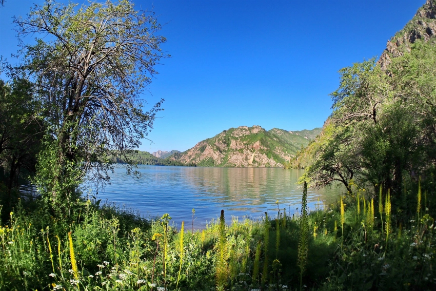
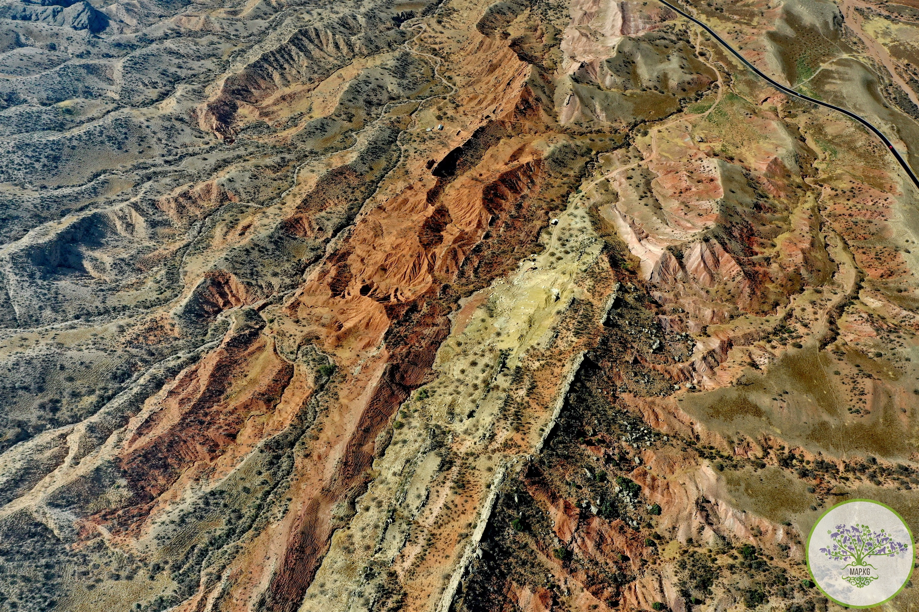
General Description: The key biodiversity area “Sumsar” in the Chatkal district of the Jalal-Abad region of Kyrgyzstan is located in the foothills of the Chatkal ridge. To reach the village of Sumsar, located in the western part of Kyrgyzstan, you need to cross mountain passes and rivers, snow-capped peaks, winding roads and breathtaking views of natural beauty.

The Sumsar River is the main source of water in the village of Shekaftar and flows through the Chatkal district in the Jalal-Abad region in southern Kyrgyzstan. The upper reaches of the Sumsar River are located in the southwest of the Chatkal ridge and the river mainly replenishes its water reserves from melted snow and glaciers. Usually, the Sumsar River fills in March-July; the flood lasts on average about 176 days.
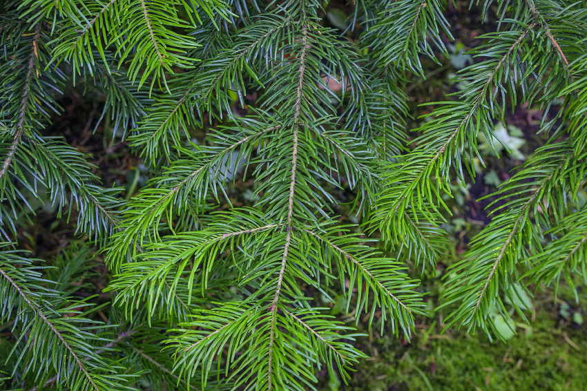
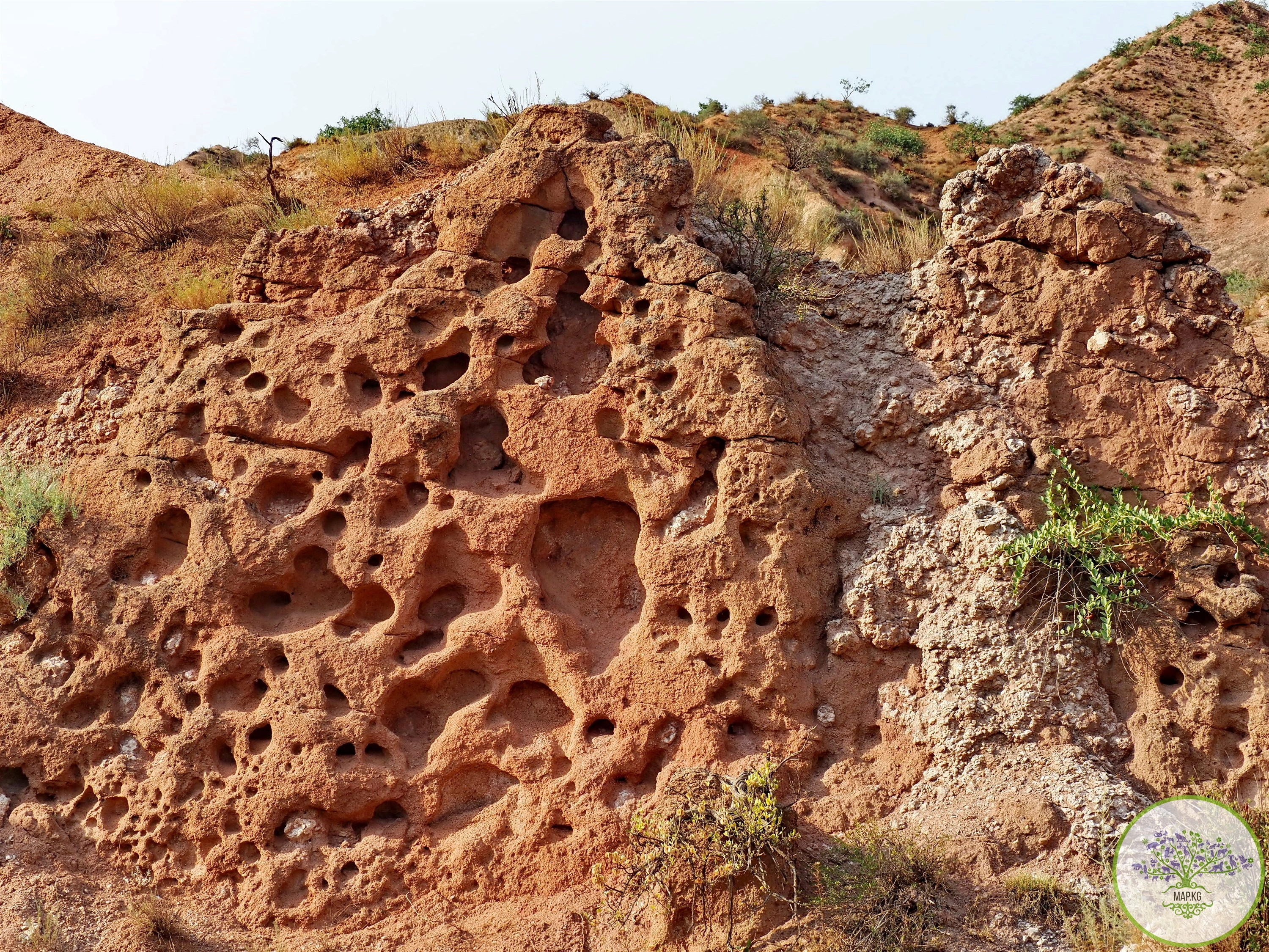
Most of the territory is occupied by high-mountain deserts, semi-deserts, and steppes bordered by mountains.
Within the key biodiversity area there are representatives of rare and endemic species (Acantholimon karabajeviorum) and Red Book species (Primula eugeniae).
The average air temperature in January is – 10°C, within c. Sumsar –2°С. In July, average monthly temperatures vary from 12°C over the main part of the region to 26°C (the village of Sumsar). The absolute minimum air temperature is minus 38°C, the absolute maximum is +36°C - + 40°C.
The average annual precipitation is 553 mm. During the warm period, up to 300 mm of precipitation falls. The possible daily maximum precipitation reaches 80 mm. The average height of snow cover is 134 cm. The highest wind speed can reach 42.5 m/sec.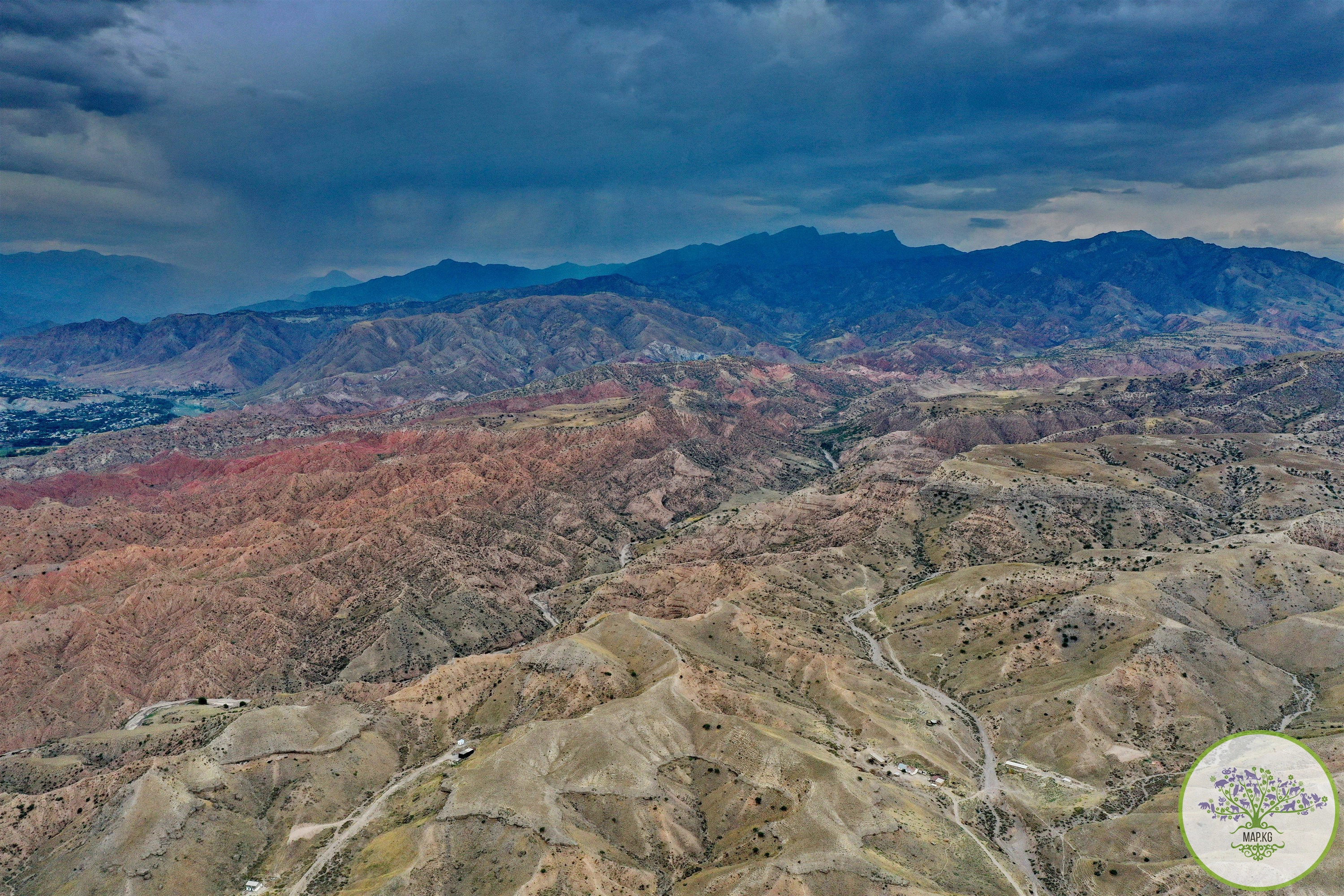

Settlements: The village of Sumsar was founded in 1952 and arose during the development of polymetallic ore deposits. Between 1952 and 1978, the deposit produced 72,000 tons of lead and 16,000 tons of zinc. In 1952–2012, Sumsar had the status of an urban village.
On September 8, 1958, the workers' village of Shekaftar was annexed to Sumsar. In 2012, the urban-type settlement of Sumsar was transformed into a village, on its basis the Sumsar Rural Administration was formed, the population of which is 6,089 people, of which 5,967 people live in the village of Sumsar.
The village of Shekaftar is located in the Southwestern part of the Chatkal region, in one of the most inaccessible areas of Kyrgyzstan, at an altitude of 1450 meters above sea level. The distance to the regional center, the city of Jalal-Abad is 248 km, to the regional center of the village of Kanysh-Kiya is 188 km. The main occupation of the local population is agriculture, mainly animal husbandry.

Environmental problems: In the area of the village of Shekaftar, from 1946 to 1957, at the initial stage of development of the nuclear industry and the arms race, a mine operated for the extraction of uranium ore. At this stage, the economic and environmental aspects of uranium mining played a second and third role. In accordance with this, such poor deposits as Shekaftar and Kyzyl-Dzhar were also involved in development. In addition, this stage was characterized by ignoring the radioecological hazard of the extracted raw materials and their waste. Serious mistakes, miscalculations and short-sightedness were made when choosing sites for waste storage facilities, which were located directly in the beds and valleys of transboundary rivers.

Until recently, in the vicinity of Shekaftar there were 8 mountain dumps of low-radioactive rocks, the total volume of which was about 700 thousand cubic meters. m. The dumps were not reclaimed and were exposed to water and wind erosion; waste from some dumps also ended up in the waters of the Sumsar River. There were residential buildings in the immediate vicinity of the dumps; local residents used materials taken from the dumps for domestic needs. In addition to rock dumps, there was a uranium tailings dump on the territory of the village, which stored radioactive and toxic waste, such as salts of heavy metals and reagents used in the processing and enrichment of ores - cyanides, acids, silicates, nitrates, sulfates. The tailings dump was one of the most dangerous for the ecology of the region. 

The condition of the tailings dump, built several decades ago, was threatening; it was significantly damaged by the effects of natural elements, and, in addition, was located in an area of increased seismic activity. Currently, with the support of the European Union, OSCE and UNDP, all dumps and tailings have been removed outside the settlement and reclaimed. Work on the transfer and reclamation of dumps and tailings was completed in 2021.

Attractions: After the end of the Great Patriotic War, as part of the implementation of the Soviet Atomic Project, active exploration of deposits of uranium and other radioactive elements was carried out in the Kyrgyz SSR. In 1946, a uranium mine opened at the Shekaftar deposit; in 1949, the urban-type settlement of Shekaftar was formed near the mine.

After the closure of the mine in 1957, the life of the village was mainly associated with the lead mine opened in 1952 in the town of Sumsar, which operated until 1978. On the technical base remaining after the mining administration, the Sumsar experimental plant “Uralenergotsvetmet” was opened, with its head office in Sverdlovsk, producing components for piston compressors and consumer goods. With the collapse of the USSR and the destruction of economic ties between the former Soviet republics, production, which was reorganized into Tulpar JSC, was left without the necessary funding and is not operating at full capacity.

Currently, due to its geographical location and due to the crisis in mining production, which was the main activity for the residents of the village, Shekaftar is in an extremely difficult situation. The village mainly lives on funding from the republican budget; unemployment among the local population is 70%. The further development of the village is largely connected with the Terek-Sai Mine gold mining plant.
Archival photo: (Shakaftar. Dam on the Sumsar River near the “Green” Bridge. Kyrgyzstan, 1950e)