KGZ21 Tyuz Key Biodiversity Area

Square: 55 000 ha.
KBA category: B1
Species that initiated the designation of KBA [and other globally threatened species that are present in the KBA but have not been confirmed to meet the global KBA criteria]: Draba alajica, Iskandera alaica, Littledalea alaica, Paraquilegia scabrifolia, Pulsatilla kostyczewii, Rindera alaica, [Betula tianschanica].
Protection areas: No
Settlements on the territory of the KBA: Sary-Bulak, Kulchu, Zhash-Tilek, Chak, Zhar-Bashi, Kara-Shybak, Daroot-Korgon, Kek-Jar, Kyzyl-Tuu, Shibee.
Adjacent to the territory of the KBA: Kochkorchu, Zhekendi, Karamyk, Kara-Teyit, Mukur.

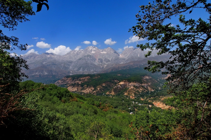
General Description. KBA Tyuz is located on the territory of the Chon-Alai district of the Osh region, or rather, 2 village districts: Zhekendi and Chon-Alai. The area is located in the valley of the mountain river Kyzyl-Suu. From the south and north, the borders pass along the Alai and Trans-Alai ridges. From the west, the KRB borders on the Lakhsh region of Tajikistan.

Kyzyl-Suu (translated from Kyrgyz as “red water”) is a transboundary mountain river flowing in Kyrgyzstan and Tajikistan. This is one of the tributaries of the Vakhsh River, part of the Amu Darya River system. The length of the river is 235 km, the drainage basin area is 8380 km². The average water flow 86 km from the mouth is 40.6 m³/sec.

The source of the Kyzyl-Suu River is located on the slopes of the Trans-Alay Range. The river flows through the Alai Valley, before the confluence of the Ailyama River it is called Karasu. Merging with the Muksu River it forms the Surkhob River. The height of the mouth is 1834 m above sea level. The climate of the valley is sharply continental, arid, with cold winters. According to the altitude of the valley, summers are cool and winters are cold with a long snowy period. The average temperature in July is +19-22 °C, in December -10-15 C.
Moist air masses coming from the west and northwest leave moisture on the slopes of the outer ridges, so the amount of precipitation is small - 500-650 mm per year.

Vegetation is subject to altitudinal patterns.
The lower zone (2500 m) is wormwood semi-deserts and dry steppes on light brown soils, developed on terraced plains and in the foothills in the western part of the valley. In the middle part, feather grass-fescue subalpine steppes predominate on dark chestnut soils.
The altitudinal zones, common on the northern slopes of the Chon-Alai ridge, alternate from bottom to top with subalpine steppes, then subalpine meadows, low-grass breezy alpine meadows are interspersed with rocks and scree. The widest range is occupied by the nival-glacial belt, located from altitudes of 3600-3900 m and up to 7000 m. Most of the area here is covered with snowfields and glaciers.

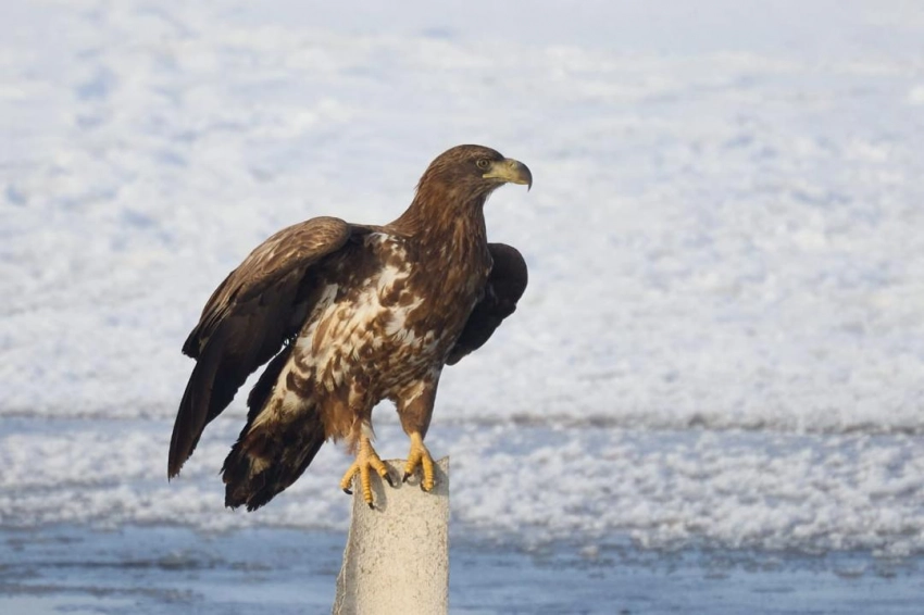
The fauna of the Alai Valley is unique. Its fauna is dominated by species found in Central Asia, Tibet and Tien Shan. Here it is possible to find stone partridges ( kekliks), snowcocks, foxes, wolves, and the unique Alai red marmot. In the past there were pheasants, the reintroduction of which is planned by local environmental activists. The rivers are inhabited by Amu Darya trout. In the high mountain zones of the mountains there are snow leopards, bears, argali and ibex (teke).

Settlements: Zhekendi aiyl district: villages of Karamyk (center), Zhekendi, Kara-Teyit, Shibee, Chuluk.
Chon-Alai aiyl district: village Daroot-Korgon (center), Zhar-Bashy, Zhash-Tilek, Zhaman-Zhar, Kochkorchu, Kulchu, Kyzyl-Tuu, Sary-Bulak, Chak, Kyzyl-Eshme, Kara-Shybak.

Ecology: The main branch of the local economy is transhumance and stable livestock farming. The overwhelming majority of natural resources are pastures. As throughout the country, in the Alai Valley there is a tendency for the number of livestock to increase. In this regard, there are problems with overgrazing of livestock, which results in pasture degradation and soil erosion.
Unfortunately, the increased activity of mining companies developing gold and coal in the foothills of the Alai Range has increased the anthropogenic load on the region’s ecosystem.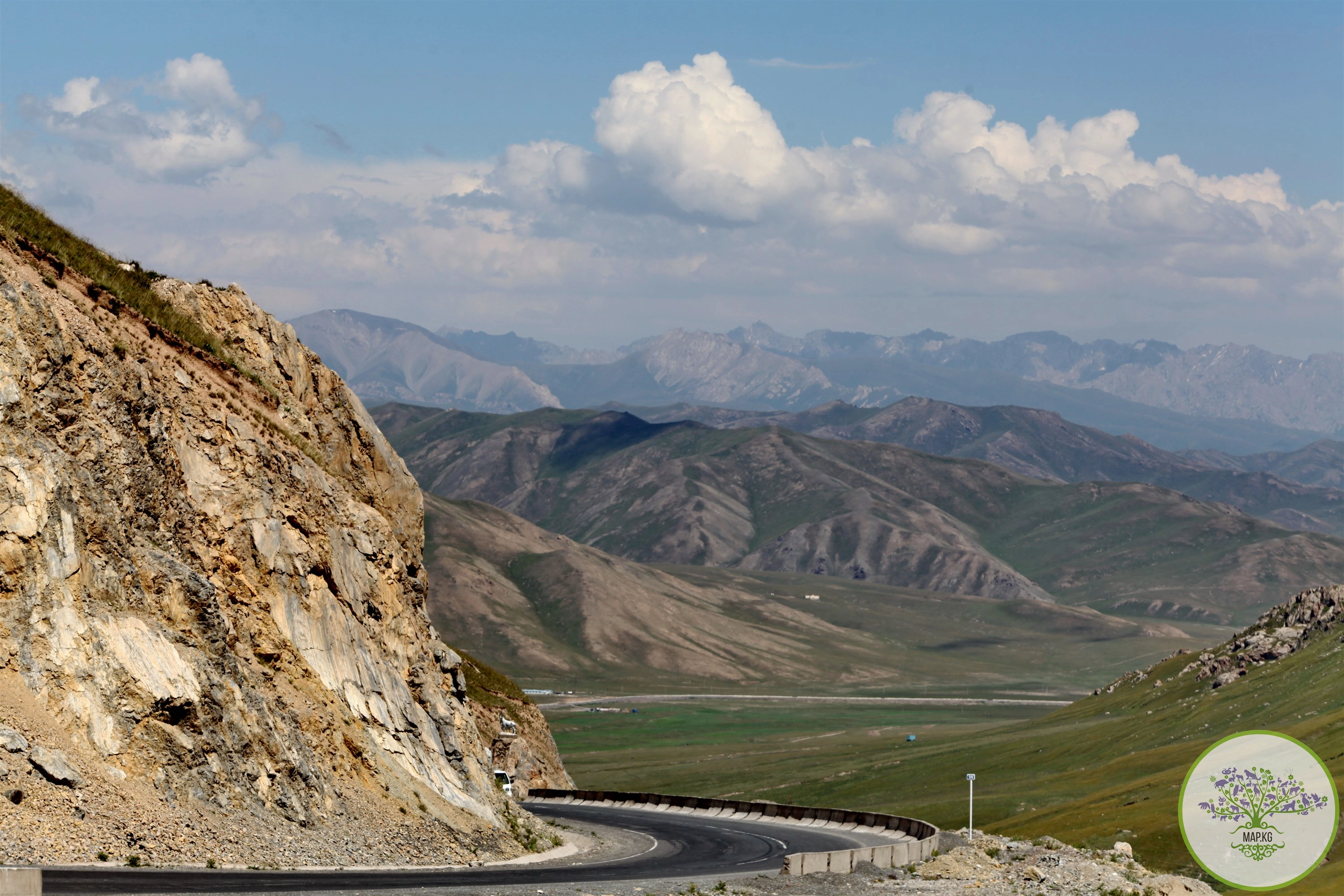

Attractions. Lenin Peak is a mountain peak of the Chon-Alai ridge on the border of Kyrgyzstan (Chon-Alai district of Osh region) and Tajikistan (Murgab district of Gorno-Badakhshan Autonomous Region). One of the “seven thousand meters” - the highest peaks of the former USSR. One of the highest peaks in Central Asia, located in the Pamir mountain system (7134 m).

In total, there are 16 climbing routes to the top. Nine along the southern slope and seven along the northern; the classic route is considered to be from the north through the Razdelnaya peak (6148 meters). The classic route does not require special skills or extensive mountaineering experience of the climber, which is why Lenin Peak is considered the most accessible seven-thousander.