KGZ30: Sary-Jaz and Khan-Tengri Key Biodiversity Area

Square: 300 000 ha.
KBA category: А1, В1
Species that initiated the designation of KBA [and other globally threatened species that are present in the KBA but have not been confirmed to meet the global KBA criteria]: Panthera unica, Asterothamnus schischkinii, Astragalus dschangartensis, Artemisia saposhnikovii, Artemisia nigricans, Chorispora insignis, Cuscuta syrtorum, Oxytropis chantengriensis, Oxytropis piceetorum, Saussurea involucrata, Saussurea kara-artscha, Seseli kaschgaricum, Sibiraea tianschanica, Taraxacum syrtorum.
Availability of protected areas: yes
Settlements on the territory of the KBA: Echkili Tash, Enilchek
Adjacent to the territory of the KBA: no

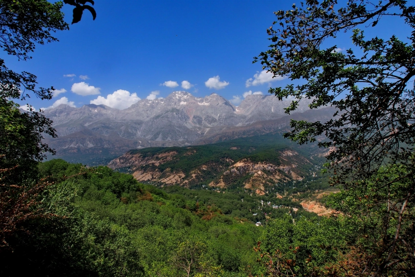
General description: The Sary-Jaz valley is located in the valley of the river of the same name and its right tributary Ak-Shiirak. The valley stretches at an altitude of 2700 m to 3600 m. Its upper part is bordered by the Sary-Jaz ridges (Semyonov peak, 5816 m) and Terskey-Ala-Too (Karakol peak, 5280 m). In Kyrgyzstan, the length of the Sary-Jaz River is 198 km . The river is fed by meltwater from snow and glaciers of the highest mountain range Muztag, mainly glaciers from the slopes of the Terskey Ala-Too and Chon-Ashu-Tor mountain ranges.

In the Sary-Jaz River basin within the Central Tien Shan there are 574 glaciers with a total area of 1546.4 km2. The Sary-Jaz River originates from the Semenov dendritic glacier, which originates on the slopes of Semenov Peak, 5816 meters above sea level at the junction of the Terskey-Ala-Too and Sary-Jaz ridges. The water in the river has an amazing greenish-white color. The river first flows through the syrts of the Central Tien Shan parallel to the Sary-Jaz ridge on the north side. At the end of the ridge, the Sary-Jaz River turns south perpendicular to the Kaindy-Katta ridge.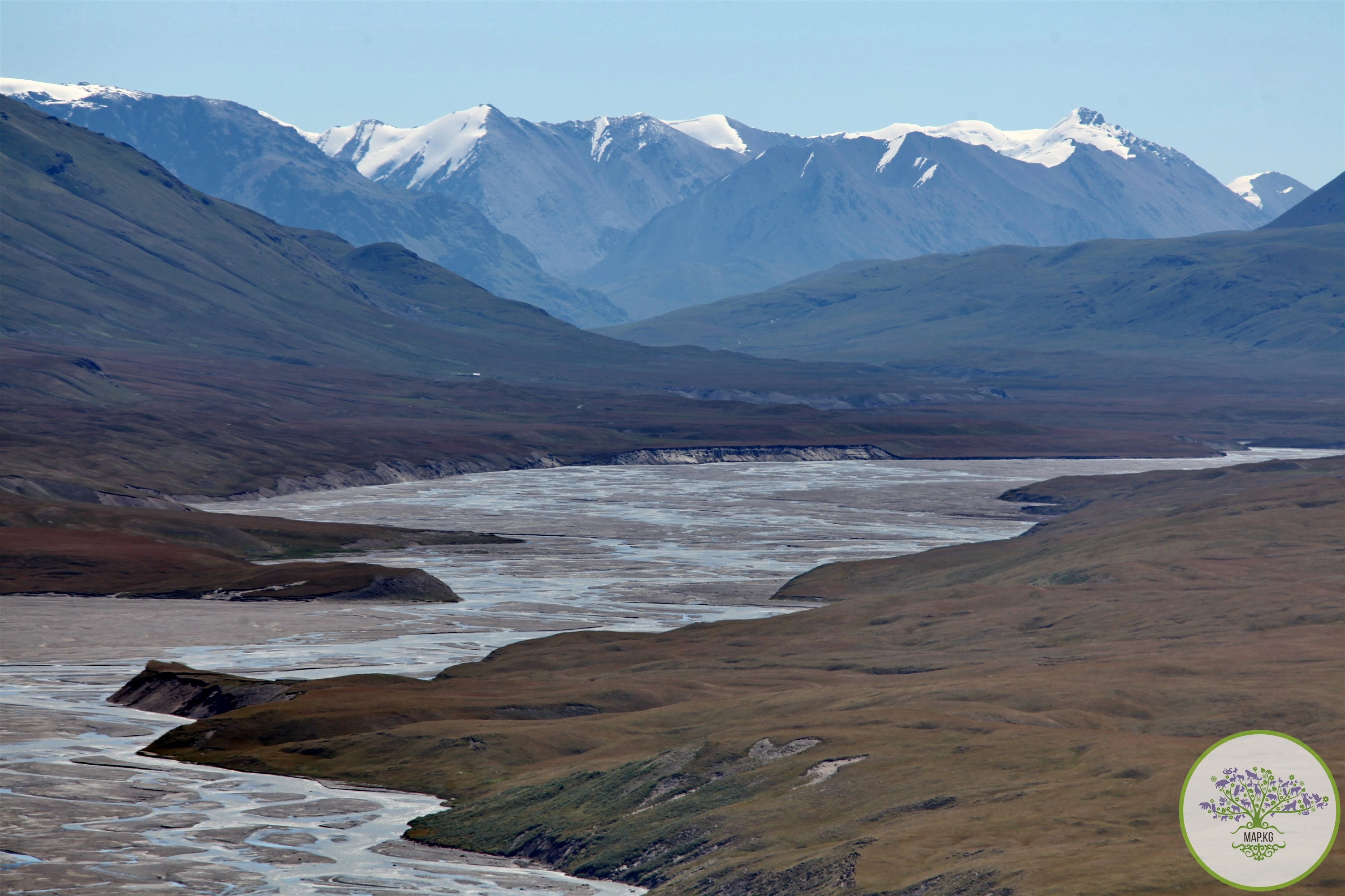

In the lower reaches, the Sary-Jaz River receives a new name Ak-Suu, a left tributary of the Tarim River (Issyk-Kul region of Kyrgyzstan and Xinjiang Uyghur Autonomous Region of China). Irrigates the Aksu oasis in China. In the upper reaches, the nature of the current is mountainous; when leaving the Tien Shan on the Tarim Plain, it becomes calm. The average water flow in the lower reaches is 208 m3/s.
The valley of the Sary-Jaz River looks like a canyon with steep sides. The valley offers a picturesque view of the jagged ridges, sharp peaks, and cirques of the surrounding ridges. The entire horizon, the mountains are surrounded by a powerful snow strip, from under which sparkling tongues of glaciers crawl out. The Sary-Jaz River cuts through the powerful Kakshaal-Too ridge and goes to China.

In the kingdom of mountain gorges and peaks with hanging tongues of snowfields, many ibex and mountain sheep (argali) live.
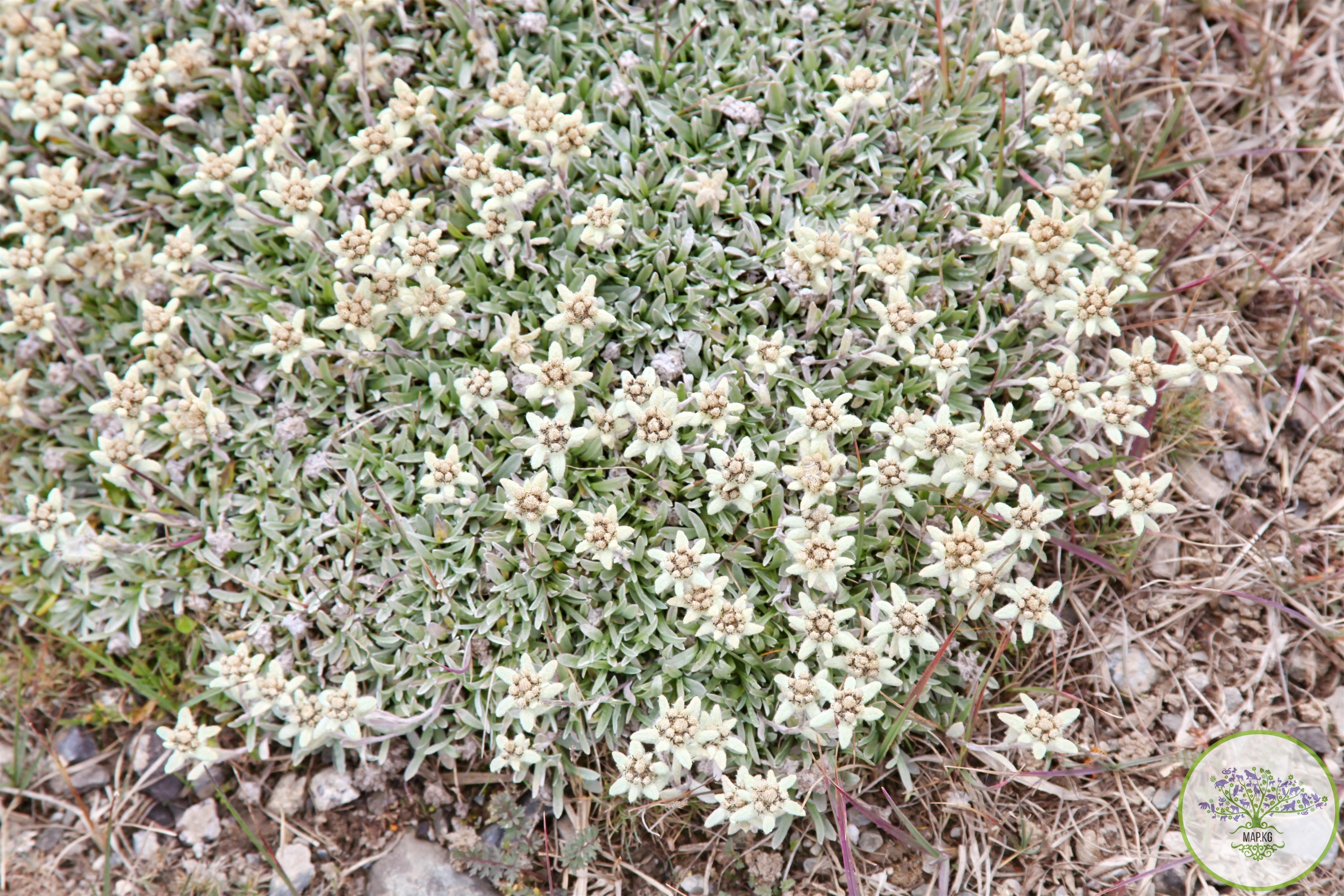
The vegetation of the Sary-Jaz valley has adapted well to harsh conditions. At an altitude of about 3000 m in the Sary-Jaz valley, the border of the high-mountain steppe belt ends, where mainly fescue, wormwood and feather grass grow. From an altitude of approximately 3000 m along the slopes you can see emerald alpine meadows, individual groves of Schrenck spruce, juniper and birch woodlands.

Above 3500 m in the Sary-Jaz valley, the vegetation is mainly represented by cushion-shaped semi-shrub xerophytes and lichens. It is easier for such plants to withstand unfavorable conditions - cold, wind, drought and destructive ultraviolet rays. Even higher is the rocky tundra. This type of landscape is distributed only in small spots on the highest ridges of the Tien Shan at 3900-4300 m above sea level.
Settlements on the territory of the KBA: Enilchek is a village in the Ak-Suu district of the Issyk-Kul region of Kyrgyzstan. Administrative center of Enilchek ayil district. According to the 2009 census, 345 people lived in the village.
Echkili-Tash is a village in the Ak-Suu district of the Issyk-Kul region of the Kyrgyz Republic near the border outpost. Part of the Enilchek ayil district Population - 6 people (according to 2021 data).

Attractions: The Sary-Jaz Valley is connected to the city of Karakol by a 140 km long road. To visit the Sary-Jaz Valley, you must obtain a pass to the border zone at the police station. Due to the harsh natural and climatic conditions, the location is recommended mainly for experienced tourists. The Sary Jaz River has great potential for organizing extreme rafting.

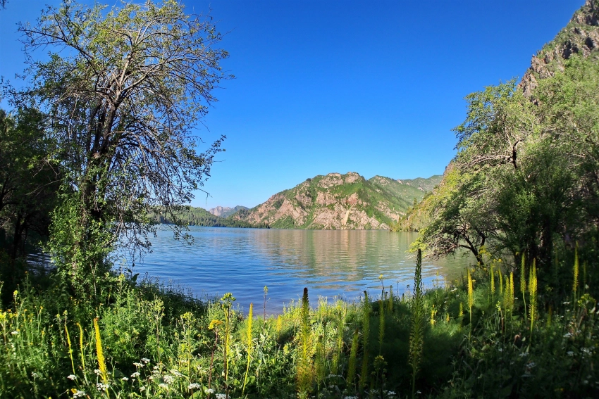
In the valley you can see the amazingly beautiful Sary-Jaz canyon, which is located near the confluence of the Sary-Jaz river and its right tributary Ak-Shiirak. 7 km east of the village of Echkili-Tash at an altitude of 3150 m in a limestone cliff on the right bank of the Sary-Jaz there is the Ak-Chunkur cave (“white pit”), about 70 m long and 4 m wide, the entrance to which rises above the water at 130 m. Traces of prehistoric man were found in it. Not far from the cave there is a small lake.

In the upper reaches of the Sary-Jaz River, near the motley marble rock Kara-Ala-Tash, there are hot springs with a temperature of about 60 degrees. Near the village of Enilchek you can see rock paintings (1-2 thousand years BC).
Sary-Jaz springs are located 3.5 km south of the village of Sary-Jaz at the foot of an almost hundred-meter cliff on the left bank of the river with the same name at an absolute altitude of about 2400 m. The first descriptions of these sources were made by geologist D.I. Yakovlev in 1932; later they were repeatedly studied by other specialists, including the most complete hydrogeologist E.A. Streltsov in 1966-1967.

The measured part of the thermal water output gives an influx of 0.26 l/s, their temperature reaches 57°C, the composition is sodium chloride-sulfate with a mineralization of up to 0.9 g/l. The water contains up to 2.5 mg/l of hydrogen sulfide, which gives it a characteristic odor, and contains molybdenum, zinc, copper, lead, and silicic acid. In composition and properties, this water is similar to the water of many other thermal springs of the republic - Issyk-Ata, Ak-Suu, Kokomeren, etc.

Khan Tengri Peak. Khan Tengri Peak in Kyrgyzstan is located east of Lake Issyk-Kul, near the border with Kazakhstan and China. Although its summit is only 6,995 meters high, thanks to the ice cap the peak reaches 7,010 meters, making it one of only five peaks in Central Asia over 7,000 meters high, and its summit is awarded the title "Snow Leopard".

Although the climb can be very dangerous and many people have died while reaching the summit, climbers still conquer this peak. There are now approved routes and base camps, and the pyramidal Khan Tengri itself is a great place for photography. Because it is located in a sensitive border area, climbers need special passes to access the peak. At the foot of the Khan Tengri peak are the Enilchek Glacier and the disappearing Merzbacher Lake.

Merzbacher Lake. Lake Merzbacher lies between the northern and southern branches of the Enilchek glacier. The mystery of Lake Merzbacher is that the lake forms every summer and flows into the Enilchek River around August. In fact, only part of the lake, which is 6 kilometers long and 1 kilometer wide, flows into the river. The lake is actually divided into two parts by an ice bridge, and when the lower part of the lake drains, the upper part is always filled with water. The lake flows twice a year, in summer and winter, but most people only know about the summer event.

In 1903, the German scientist Gottfried Merzbacher was the first to discover the lake during his expedition to Khan Tengri. Having deviated from the intended route, through the Byankol pass, along the Semyonov and Mushketov glaciers, he tried to gain height from the Enilchek glacier. He was unable to approach Khan Tengri, but was able to establish that Khan Tengri was located on a ridge, and not in the center of the mountain ring, as was previously believed. The expedition became famous most likely for the discovery of a mysterious lake, which now bears the name of Merzbacher.

The expedition came across a lake at an altitude of 3,500 meters above sea level, sandwiched between two branches of a glacier and a surface covered with icebergs. The lake suddenly dried up in front of the expedition members. Another group of researchers, approximately 28 years later, witnessed approximately the same incident. To their surprise, the lake disappeared, leaving huge blocks of ice at the bottom. Notes from members of the expedition indicate how water poured into the cracks with a roar, which greatly frightened the horses. Part of the expedition returned the following year to find the lake refilled. Merzbacher Lake is perhaps the most famous of the “disappearing lakes,” but there are several other similar phenomena around the world. Iceland, Switzerland and the island of Greenland have similar lakes, and only Lake Merzbacher seems to be so precise in the timing of its discharges.

Ecology: In Soviet times, a grandiose construction of a tin ore plant began in Sary-Jaz. And if not for the collapse of the Union, the village of Enilchek would definitely have become one of the largest suppliers of valuable metals necessary for industrial development. Currently, the development of the deposit is carried out by Saryjaz Mineral Mining Company LLC.

* https://open.kg/about-kyrgyzstan/nature/water-resources/mineral-water/2360-sary-dzhazskie-rodniki.html
** In general, the length of the river is 400 kilometers, the basin area is 28.5 thousand km2.